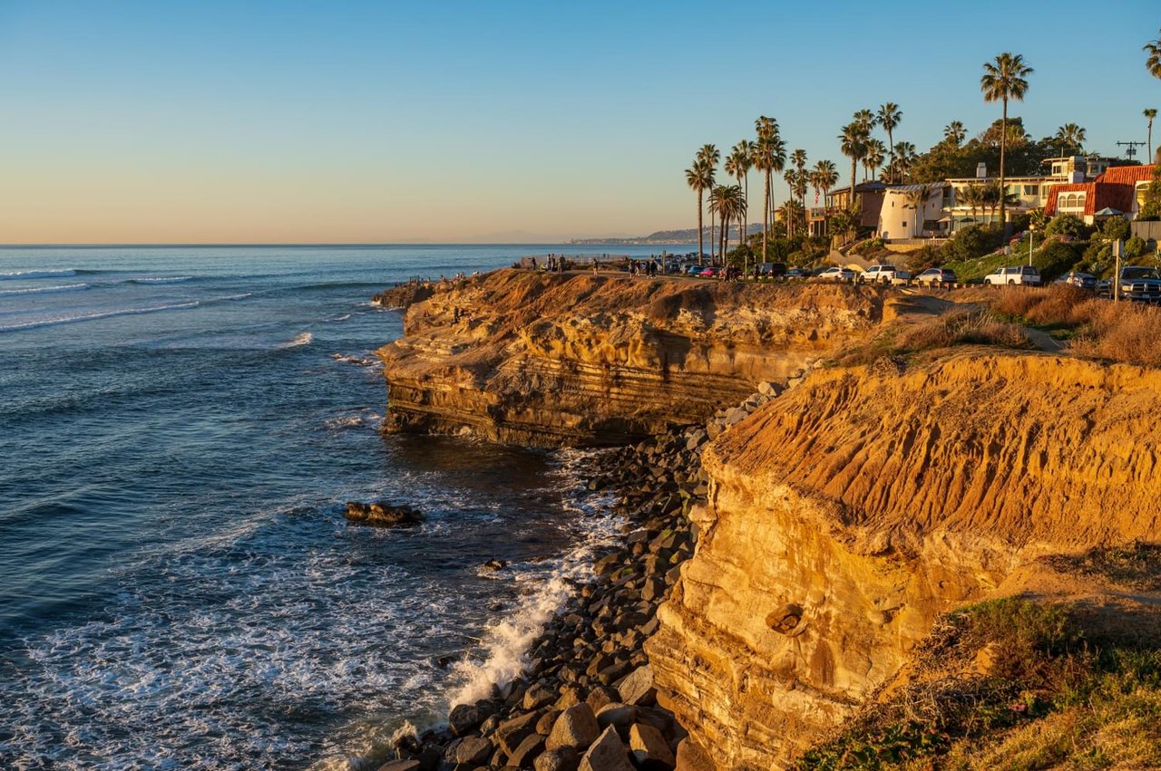
Walk Sunset Cliffs Boulevard between Adair and Froude streets this month and you will notice two things that seem unrelated until you look closer. First, a run of caution tape and orange fencing pushes foot traffic off the bluffside path and into the bike lane, the kind of temporary rerouting that has apparently become permanent enough that longtime residents have stopped remembering what the sidewalk looked like before it. Second, a few hundred feet south, a cluster of teenagers with phones held sideways waits its turn at a rock formation locals call the Arch, while a lifeguard truck idles nearby with someone on a bullhorn asking them, again, to get down.
Those two scenes are not two stories. They are one story, told from opposite ends of the same eroding stretch of coastline, four months apart.
One Arch, Two Headlines
In April, a section of bluff near the Arch broke off, a collapse an SDSU geology professor described as unsurprising given that the sandstone underneath Point Loma is roughly 75 million years old and has been fracturing under wave action and rainfall runoff for longer than anyone alive has been watching it. The professor's warning at the time was straightforward: the rock is not stable, the timeline for further failure could be twenty years or it could be tomorrow, and nobody standing near a crack should assume they have advance notice.
By early August, that same landmark was the epicenter of a very different kind of problem. Videos of people leaping from the Arch and from a spot known as Pappy's Point, tucked between Osprey and Froude streets, had gone viral enough to pull in visitors from as far as Corona and San Bernardino County, some making the drive specifically because the clips were trending. A 17-year-old suffered six spinal compression fractures after striking rock during a jump, an injury serious enough that San Diego police and fire officials moved to a visibly heavier enforcement posture almost immediately. Over one weekend in early August, officers issued seven citations and forty warnings. In the weeks around it, the cumulative count reached 18 misdemeanor citations and roughly 300 warnings, a scale of enforcement that would have been unthinkable at this location even a year ago.
Here is the detail worth sitting with: the ground that gave way in April and the ledge people are diving from in August are, functionally, the same few hundred yards of cliff. One event was geology doing what geology does. The other is a crowd treating that same instability as a stunt backdrop. The city is responding to both, on two completely different timelines, with two completely different tools.
The 2026 timeline, condensed:
- January 2026 — a localized bluff failure near Adair and Osprey streets takes out a section of railing.
- April 14, 2026 — a bluff section near the Arch breaks off, prompting public warnings from a San Diego State geologist about the risk of cliff jumping in the area.
- May 12, 2026 — the city presents a $32.59 million seawall proposal at a meeting at the Point Loma Hervey Branch Library, aimed at the same Adair-to-Osprey stretch.
- June 2026 — caution tape rerouting pedestrians into the bike lane draws complaints about congestion on the boulevard.
- Late July into August 2026 — viral cliff-jumping videos bring crowds and a formal police and lifeguard crackdown to Pappy's Point and the Arch.
What the Crackdown Actually Looks Like
The legal mechanics are simpler than the enforcement numbers suggest. City law makes it illegal to jump or dive into the ocean from more than five feet above the water. First citations run about $100. Escalate to a formal misdemeanor charge and the fine climbs to as much as $500, with jail time technically on the table, though in practice the goal has clearly been deterrence rather than prosecution. A retired city lifeguard who jumped from these same cliffs as a teenager in the 1950s through the 1980s put it plainly to a local reporter this month: people are going to keep jumping here regardless of the citations, because the crowds knew the water and the currents back then, and today's viral-video crowd often does not.
That gap, between locals who grew up reading the swell and out-of-towners chasing a clip, is a big part of why officials have leaned so hard into visible enforcement rather than just signage. Warning signs have been posted at the Arch for years. They were posted in April, after the collapse. They did nothing to slow the August crowds.
The Slower Fix, a Few Hundred Feet Away
The seawall project presented at the Point Loma Hervey Branch Library in May is aimed at the same corridor, but it moves on an entirely different clock. The proposal covers 335 linear feet between two existing seawall segments near Adair and Osprey streets, combining a 205-foot tieback wall with a 130-foot secant pile wall. At roughly $32.59 million, that pencils out to close to $100,000 per linear foot, a figure the city's own project team acknowledged was steep enough to warrant public pushback at the meeting.
As of this summer, there is no money allocated to build it. The design phase and public outreach are still underway, and the city's own analysis of doing nothing is blunt: without intervention, the boulevard and the linear park itself face meaningful risk of closure as erosion continues, since sea caves are already undercutting the bluff within twelve feet of the roadway in places. If funding comes through, the earliest realistic construction start is late winter 2027, with permitting and funding alone expected to take about 20 months.
There is also a philosophical snag baked into the park's own founding documents. The Sunset Cliffs Natural Park master plan explicitly frames the eroding cliffs as a feature, not a flaw, something visitors are meant to observe as a natural process rather than something the city engineers away. The California Coastal Commission has pushed back on parts of the seawall design for similar reasons, rejecting the use of riprap at the base and asking instead for a study on sand nourishment, a softer, more natural-looking alternative that would take longer to model but fit the park's stated vision more comfortably.
Why the Boulevard Itself Is the Bottleneck
One detail from a June ride-along account captures the day-to-day friction better than any planning document: with the pedestrian path taped off between Adair and Osprey, walkers have been diverted into the bike lane, turning an already congested stretch of boulevard into a shared space nobody quite planned for. The city has floated converting the section of boulevard south of Monaco Street into a one-way road, freeing up space for a proper pedestrian path. It is still a proposal, not a schedule, but it is the closest thing on the table to actually resolving the pedestrian, bike, and increasingly heavy lifeguard-patrol traffic all competing for the same narrow strip of asphalt.
The Practical Rundown for This Stretch Right Now
If you are walking, running, or just trying to catch sunset without losing forty-five minutes to a parking hunt, here is what is still reliable on the ground this month.
If you want... | Park at | Know before you go |
|---|---|---|
Tide pools | Ladera Street & Cornish Drive lot | Aim for a minus tide of 0.7 feet or lower, within about two hours of low tide |
Sea caves | Froude Street lot (3980 Lomaland Drive) | This is also the departure point for guided cave tours, and the area with the heaviest recent lifeguard presence |
Fewer crowds at sunset | Luscomb Point lot, south end of the park | Typically less crowded than the main Ladera Street lot; Tuesday and Wednesday evenings are also the lightest nights overall |
Walking a dog | Anywhere in the park | Dogs are not permitted between 9 a.m. and 6 p.m.; outside those hours, leash is required |
Friday and Saturday evenings from spring through fall, the lots and street parking along the boulevard fill completely 45 to 60 minutes before sunset. That has not changed this year. What has changed is that arriving early might also mean parking next to a squad car.
What This Means for the Next Twelve Months
Residents along this stretch should expect the current state of things to persist rather than resolve quickly. The seawall has no construction funding yet and a permitting runway measured in years, not months. The one-way pilot is still a proposal. The crackdown at Pappy's Point will likely ease and flare with whatever the next viral clip does, since citations alone have not changed behavior in the way officials had hoped. The park is, in a very literal sense, a place in motion, both geologically and administratively, and the honest read for anyone who lives here is that the boulevard you walk today will keep looking slightly different than the one you remember from last year.
That is not a reason to love this stretch of coastline any less. If anything, watching a place get argued over this closely, by geologists, by the Coastal Commission, by a city trying to balance a natural park's founding vision against a $32 million engineering bill, is its own kind of evidence for how much this particular few hundred yards of San Diego is worth protecting.
If you are thinking about what a home along this corridor is actually worth once you understand what is happening to the ground beneath it, that is a conversation Quin Gaughan | San Diego REALTOR is glad to have. Let's Connect.